NASA uses satellites and debris to navigate without GPS
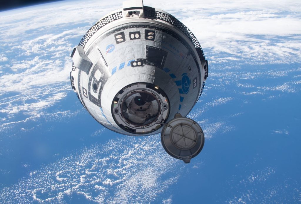
One of the greatest challenges facing future space exploration is deceptively simple: knowing exactly where a spacecraft is. For decades, satellites orbiting Earth have relied heavily on the Global Positioning System (GPS) and extensive ground-based tracking networks. Yet as humanity prepares to establish a sustained presence on the Moon, send robotic missions deeper into the Solar System and eventually transport astronauts to Mars, those traditional navigation approaches become increasingly limited.
NASA has now demonstrated a technology that could fundamentally change how spacecraft navigate. Through its Starling mission, the space agency has successfully tested a system called FALCON (Fast Autonomous Lost-in-space Catalog-based Optical Navigation), enabling a spacecraft to determine its position by observing other satellites and debris in space rather than depending on GPS signals or continual instructions from Earth. The breakthrough may sound highly specialised, but its implications extend far beyond spacecraft operations. In the long term, autonomous space navigation could improve satellite safety, support lunar infrastructure, enable more sophisticated scientific missions and create new commercial opportunities within the rapidly expanding space economy.
The space around Earth is becoming increasingly congested. Thousands of operational satellites share orbital regions with spent rocket stages, inactive spacecraft and fragments of debris. At the same time, emerging satellite constellations are transforming telecommunications, navigation and Earth observation. Traditional navigation systems rely significantly on GPS signals and continuous monitoring from Earth-based tracking stations. These approaches work well near Earth but become less practical farther away. Around the Moon, GPS coverage is limited. Beyond cislunar space, spacecraft cannot depend on existing terrestrial navigation systems. This problem becomes even more significant when considering future fleets of spacecraft operating simultaneously. Planned lunar infrastructure may include communications satellites, science orbiters, autonomous landers and robotic support vehicles, all needing to know their precise locations at all times. NASA’s response to this challenge has been the development of increasingly autonomous systems capable of making decisions without constant human intervention.
How FALCON works
The newly demonstrated FALCON system is part of NASA’s Starling mission, a technology demonstration involving four CubeSats operating as a coordinated swarm in low-Earth orbit. The broader Starling programme aims to test technologies that allow groups of small satellites to operate cooperatively with reduced reliance on ground control. FALCON approaches navigation in a fundamentally different way.
Instead of asking “Where am I relative to Earth?”, the spacecraft asks “What objects can I see around me?”
The system uses onboard star-tracker cameras, instruments normally employed to determine spacecraft orientation by observing stars and other bright objects. FALCON extends this capability by identifying nearby spacecraft and orbital debris and comparing these observations with a catalogue of known objects. Once the observed objects are matched to entries in the catalogue, the spacecraft can calculate its own orbital position using those objects as reference points. This effectively allows a spacecraft to navigate using its environment, much as ancient mariners once used stars to determine their location on Earth. The technology was developed through a collaboration between NASA and EraDrive, a Silicon Valley startup that emerged from Stanford University research. EraDrive contributes its Era-Core flight software and embedded navigation algorithms, which work alongside Starling’s onboard cameras and spacecraft systems.
Space debris becomes a navigational asset
Seemingly the most intriguing aspect of the demonstration is the way FALCON treats orbital debris. Space debris is usually discussed as a growing hazard. According to numerous studies, collisions between satellites and debris fragments represent one of the most significant long-term risks facing the space industry. Tracking and managing these objects has become a major international priority. FALCON does not eliminate those concerns, but it converts them into useful reference points. During testing, the system identified known spacecraft and debris objects from a catalogue containing approximately 20,000 orbital objects. These observations were then used to calculate Starling’s own orbit without requiring navigation information from external networks. In effect, the spacecraft turned the surrounding orbital environment into a dynamic map. The achievement represents what NASA describes as the first time a spacecraft has autonomously determined its orbit through optical observations of other space objects rather than conventional navigation methods.
in the trial, FALCON did more than simply locate itself. NASA engineers also tested whether the spacecraft could improve existing orbital data for the objects it observed. After mission controllers uploaded a catalogue of approximately 20,000 space objects and their predicted trajectories, FALCON continuously compared those predictions with actual observations. Over a three-day period, the autonomous system refined the orbital information of more than 200 space objects without any intervention from operators on Earth. NASA reported that some of these revised orbital estimates became more accurate than those contained within the original catalogue. This capability could have major implications for space traffic management.
Today, governments and commercial operators invest substantial resources into tracking satellites and predicting potential collisions. Autonomous systems capable of updating orbital information directly from space may eventually supplement existing ground networks, providing faster and potentially more comprehensive situational awareness.
NASA’s Artemis programme aims to establish a sustained human presence on and around the Moon. Future missions may involve constellations of small satellites supporting communications, navigation, scientific observations and logistics activities. Similar architectures have been proposed for Mars exploration. Such distributed missions require satellites to operate cooperatively while maintaining accurate knowledge of their positions. Traditional navigation methods become increasingly challenging when communication delays grow and ground support becomes limited. Autonomous navigation technologies like FALCON could allow spacecraft swarms to maintain positioning information independently, improving mission resilience and reducing operational complexity. NASA plans to expand the experiment later this year. The four Starling spacecraft will share tracking data with one another, collectively improving their navigation estimates through cooperative observations. If successful, this would represent another step towards self-organising spacecraft networks capable of functioning much like biological systems, where individual units continuously exchange information for collective benefit.
The significance of autonomous navigation extends beyond government science missions. The global space economy is projected to grow substantially over coming decades, driven by communications, Earth observation, manufacturing and emerging commercial services. As orbital activity expands, managing satellite traffic efficiently will become increasingly important. FALCON-like technologies could reduce operational costs by decreasing dependence on ground-based tracking infrastructure. Satellites capable of independently determining their positions require fewer communications resources and can potentially respond more quickly to changing conditions. The technology may also strengthen commercial efforts focused on autonomous satellite servicing, debris removal and in-space manufacturing. These activities often require precise positioning and close-proximity operations, areas where autonomous navigation could provide significant advantages. There are also safety benefits. More accurate onboard tracking and orbit estimation could improve collision avoidance, helping protect valuable satellite assets while reducing the likelihood of creating additional debris.
The commercial dimension is highlighted by EraDrive’s involvement. What began as university research evolved into a startup company whose technology has now been validated under real orbital conditions. This provides a textbook example of how government research programmes can accelerate innovation and create pathways for technology transfer into the private sector.
A glimpse of truly autonomous spacecraft?
Roger Hunter, programme manager for NASA’s Small Spacecraft and Distributed Systems programme, described FALCON as another major success for the Starling mission and emphasised its potential importance for collision avoidance, space traffic monitoring and alternative navigation systems. The broader significance may be even greater. since spacecraft autonomy is emerging as one of the defining themes of modern aerospace engineering. Future vehicles will increasingly need to make decisions independently, adapt to changing environments and coordinate activities without constant supervision from Earth. Rather than depending on external navigation resources, spacecraft are beginning to gain the ability to understand their surroundings, determine their positions and update their knowledge of the environment autonomously. The achievement may not generate the excitement associated with a moon landing or a Mars rover, yet technologies like this often prove transformative. Reliable, autonomous navigation forms part of the hidden infrastructure that enables more ambitious exploration.
NASA uses satellites and debris to navigate without GPS
#NASA #satellites #debris #navigate #GPS